- Joined
- Feb 12, 2013
- Messages
- 160,900
- Reaction score
- 57,844
- Gender
- Undisclosed
- Political Leaning
- Centrist
Dayum, Alaska just got a pretty big demotion in the adjusted scale.
Not nearly as badly as Greenland.
")

Dayum, Alaska just got a pretty big demotion in the adjusted scale.
Still not a White RW Christian conspiracy "which intentionally minimized the "Dark Continent."
Better not to care about anything - much easier that way. Not caring is golden attitude, way to go.
For me that map was interesting as it shows how big Africa is and it should "trigger" some brain cells. But maybe Not giving a F*** is smarter way, who knows
The question on the table is why should I care about Africa?
The answer has not been forthcoming.
Oh brother...
Well now sure people these days are generally ignorant ****s who are very unpleasant to be around, because people generally suck now......people used to be better......but I still want an answer......Why should I care about Africa?
Follow me here, k? When you leave the size of the "Dark Continent" stable and puff up the size of everything around it by blowing their true size way out of proportion, you have, by definition, minimized it. Capeesh?
It was more about uniting African economies under a new pan-African gold+oil standard than a political union, but yes, this is why Col. Qaddafi was taken out. It's the same reason Saddam Hussein was taken out--or at least one of the reasons.That's probably why Obama had Qaddafi killed. He was about to unite many of the African countries.
Mercator Projector as the link discussed. I'm certain any intelligent, mature and sane adult would capeesh that it's not a conspiracy to minimize the "Dark Continent" when the same thing happens to all areas near the equator as your own Wiki animated graphic displays.
Come on, though. What's more important? Maps that people can actually use to navigate, or maps useless for navigation at most latitudes but ensure every beady-eyed child knows a bunch of countries fit inside Africa?They aren't "fake maps", it's just the limitations of a Mercator projection map -- trying to fit a sphere onto a flat piece of paper. The opposite effect happens to both the Arctic and Antarctic. There is not conspiracy to minimize or maximize anything.
Mercator projection - Wikipedia
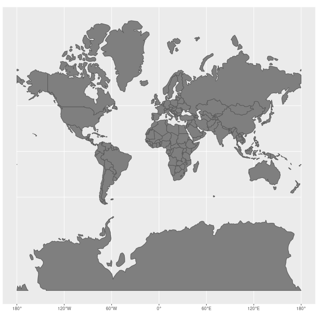
It became the standard map projection for navigation because of its unique property of representing any course of constant bearing as a straight segment. Such a course, known as a rhumb or, mathematically, a loxodrome, is preferred by navigators because the ship can sail in a constant compass direction to reach its destination, eliminating difficult and error-prone course corrections. Linear scale is constant on the Mercator in every direction around any point, thus preserving the angles and the shapes of small objects and fulfilling the conditions of a conformal map projection. As a side effect, the Mercator projection inflates the size of objects away from the equator. This inflation starts infinitesimally, but accelerates with latitude to become infinite at the poles. So, for example, landmasses such as Greenland and Antarctica appear far larger than they actually are relative to landmasses near the equator, such as Central Africa.
Coincidence that those places just happen to be full of mostly brown people? I think not.
Come on, though. What's more important? Maps that people can actually use to navigate, or maps useless for navigation at most latitudes but ensure every beady-eyed child knows a bunch of countries fit inside Africa?
If you answer "maps people can actually use to navigate", that's just you asserting your white map privilege.
Coincidence that those places just happen to be full of mostly brown people? I think not.

Also 100% true: "Africa" and "Asia" are shorter words than "America" and "Australia" because white people wanted bigger continent names than those continents "full of mostly brown people" [sic].LOL. Silly me thinking that everyone is reasonable, intelligent and well read about navigation....how white of me!
Also 100% true: "Africa" and "Asia" are shorter words than "America" and "Australia" because white people wanted bigger continent names than those continents "full of mostly brown people" [sic].
The sad thing being that I have no doubt somebody would eventually start a thread on this if they felt they could find people dumb enough to believe it.
You think Canada is NOT in North America? You honestly think America IS A COUNTRY???? :shock:
They don't even teach geography in public school anymore? Too busy teaching political correctness?

It was more about uniting African economies under a new pan-African gold+oil standard than a political union, but yes, this is why Col. Qaddafi was taken out. It's the same reason Saddam Hussein was taken out--or at least one of the reasons.
Incidentally, although it was Pres. Obama at the helm when the US fomented the "Arab Spring", he'd have been executed no matter who'd been in the Oval Office at the time.
Both Col. Qaddafi and Saddam Hussein were murderers and brutal dictators, but this isn't why they were taken out. Moreover, in Qaddafi's case the US knew well that killing him would completely destabilize Libya and shortly cause men even more brutal to rise to power. Their objective was certainly not to make life easier for Africans.Gaddafi was a brutal thug who was “taken out” to keep him from slaughtering his own people en masse like he had slaughtering others in years past. He was a rapist who was responsible both directly and indirectly for the murder of huge numbers of innocent people.
Saddam Hussein was also a brutal thug, and one who did literally everything in his power to make people think he was involved with 9/11
Big enough to stick almost all the popular countries from the other continents into it.

I've read about the fake maps we grew up with, maps which intentionally minimized the "Dark Continent." But, the pic above really makes that clear, IMO.
South Florida ends up in Congo and owned by China? No deal.
Fun fact: every planet in the solar system can fit between the earth and the moon.
View attachment 67272092
Why should I care?
Big enough to stick almost all the popular countries from the other continents into it.
I've read about the fake maps we grew up with, maps which intentionally minimized the "Dark Continent." But, the pic above really makes that clear, IMO.
Big enough to stick almost all the popular countries from the other continents into it.
I've read about the fake maps we grew up with, maps which intentionally minimized the "Dark Continent." But, the pic above really makes that clear, IMO.