1. Matter expands when it is heated, which is why mercury thermometers work. The sea expands when it is heated too, which means we can use the entire ocean to measure temperature by measuring sea level. This is done today by satellite (and validated against tide gauges at seaports). These satellite measurements have a total error from all sources of 5.8 mm (Nerem et al. 2011). In 1998, the measured sea level anomaly was 10.1 mm. In 2014 the sea level anomaly was 63.6 mm, and so far in 2015 it is 71.3 mm. Thus it is warmer today than it was in 1998, and beyond the level of error.
http://sealevel.colorado.edu/files/2015_rel4/sl_ns_global.txt
2. When the sea warms, evaporation increases, and the amount of water vapor in the air increases; when the sea cools, evaporation decreases and the amount of water vapor in the air decreases. Thus the amount of water vapor in the air is a proxy for temperature, and it can be measured by satellite. These measurements have a mean error of 0.013 kg/m² (Greenwald et al. 2007). In 1998, total precipitable water (TPW) anomaly was 0.544 kg/m². In 2015 it was 1.193 kg/m², higher than 1998 and beyond the range of error.
ftp://ftp.remss.com/vapor/monthly_1deg/tpw_v07r01_198801_201512.time_series.txt
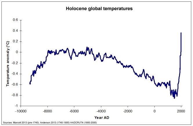
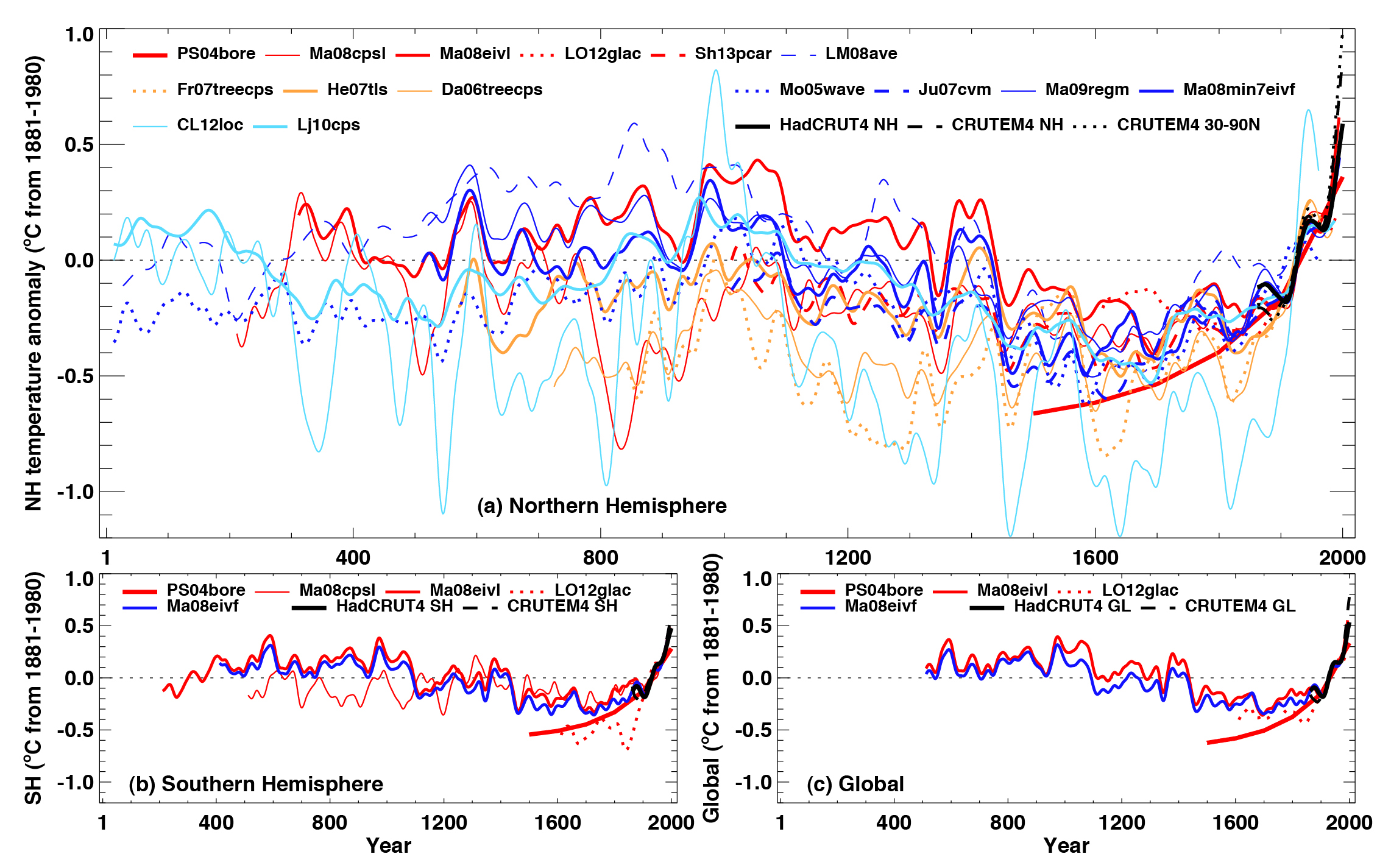
3. The Berkeley Earth Surface Temperature (BEST) project shows global surface temperature anomaly, using air temperature above the sea ice, was 0.569°, ±.047° in 1998; while in 2015, the anomaly was 0.719° ±.046°, higher than in 1998 and beyond the range of error.
http://berkeleyearth.lbl.gov/auto/Global/Land_and_Ocean_summary.txt
4. BEST also shows global surface temperature anomaly, using water temperature below the sea ice, was 0.526°, ±.050° in 1998; while in 2015, the anomaly was 0.759° ±.048°, higher than in 1998 and beyond the range of error.
5. NASA's Goddard Institute of Space Studies (GISS) shows global surface temperature anomaly was .63°± .05 (using the meteorological year, Dec-Nov), while for 2015 it is .84°± .05, higher than in 1998 and beyond the range of error.
http://data.giss.nasa.gov/gistemp/tabledata_v3/GLB.Ts+dSST.txt
6. The National Centers For Environmental Information (NCEI) dataset has an error of .03° (Smith 2008) and shows the global surface temperature anomaly in 1998 was 0.63°, while in 2014 it was 0.74°, higher than in 1998 and beyond the range of error.
http://www.ncdc.noaa.gov/cag/time-series/global/globe/land_ocean/ytd/12/1880-2015.csv
7. Radiosonde Atmospheric Temperature Products for Assessing Climate dataset A (RATPAC-A) has annual errors of .03° (Free et al. 2004) and at the surface shows a global air temperature anomaly of 0.44° in 1998, and 1.02° in 2015, higher than in 1998 and beyond the range of error.
http://www1.ncdc.noaa.gov/pub/data/ratpac/ratpac-a/RATPAC-A-annual-levels.txt
8. RATPAC-A for the 850-mb level shows global air temperature anomaly of 0.52° in 1998, and 0.71° in 2015, higher than in 1998 and beyond the range of error.
And since I have actually shown eight, then the statement that the earth hasn't warmed since 1998 is the lie. Any guesses who the liar is
?
Normally I'd ask you for a link for that false statement, but since you've already been so badly embarrassed in this post, I have no doubt that you won't have the courtesy to reply.


")